13 Years Experience
Uttarakhand Trekking Camping

Renuka Vihar, Bangali Kothi Chowk
Opposite Uttrakhand Gramin Bank
Banjarawala, Dehradun
Uttarakhand 248001
Here's a detailed overview of the Kalindi Khal Trek presented in bullet points:
Weather: Weather conditions during the Kalindi Khal Trek vary significantly depending on the season. Summers (May to June) are relatively mild with temperatures ranging from 5°C to 15°C at lower elevations. Monsoons (July to September) bring heavy rainfall and the possibility of landslides. Winters (October to April) are cold with temperatures often dropping below freezing, especially at higher altitudes.
How to Reach: The trek to Kalindi Khal usually starts from the town of Gangotri in Uttarkashi district, Uttarakhand, India. Gangotri is accessible by road from major cities like Dehradun and Rishikesh.
Distance: The total trekking distance for the Kalindi Khal Trek is approximately 100-120 kilometers, depending on the specific route taken and the starting point.
Location: Kalindi Khal is located in the Garhwal Himalayas of Uttarakhand, India, connecting the Gangotri and Badrinath valleys.
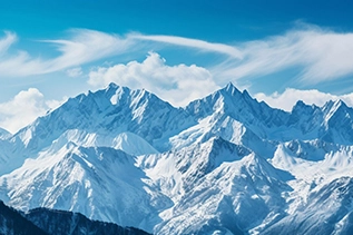
Peaks: The trek offers views of several prominent peaks in the Garhwal region, including Bhagirathi, Shivling, Meru, and Bhagirathi Parbat.
Difficulty: The Kalindi Khal Trek is considered one of the most challenging treks in the Indian Himalayas. It involves crossing high-altitude passes, navigating crevasse-ridden glaciers, and enduring extreme weather conditions. Previous high-altitude trekking experience is highly recommended.
Duration: The trek typically takes around 12-14 days to complete, including acclimatization days, trekking, and rest days.
Preparation: Trekkers must be physically fit and mentally prepared for the demands of high-altitude trekking. Adequate training, including cardiovascular exercises and strength training, is essential. Proper gear, including warm clothing, trekking boots, a sleeping bag, and a backpack, is necessary. Trekking permits and medical insurance are also recommended.
Height: The Kalindi Khal Pass is situated at an altitude of approximately 5,947 meters (19,511 feet) above sea level.
Itinerary: The typical itinerary involves trekking from Gangotri to Gaumukh, then traversing the Gangotri Glacier to reach Nandanvan and Vasuki Tal. From there, trekkers ascend to the Kalindi Khal Pass before descending to Arwa Tal and Mana Village, ending at Badrinath.
Starting Point: The trek to Kalindi Khal usually starts from the town of Gangotri, which serves as the base camp for the trek.
Best Time to Visit: The best time to undertake the Kalindi Khal Trek is during the summer months from May to June and the post-monsoon season from September to October when the weather is favorable, and the trails are accessible.
Booking: Trekkers are required to obtain permits from the forest department and register at Gangotri before starting the trek. Accommodation in Gangotri and transportation to and from the trekking trailhead may need to be arranged in advance.
Camping: Camping is an integral part of the Kalindi Khal Trek, with trekkers setting up tents at designated campsites along the route.
Package: We offer packages for the Kalindi Khal Trek, which may include transportation, accommodation, guide services, meals, camping equipment, permits, and medical assistance. It's advisable to research and choose a package that suits your preferences and budget.